 FEAMP GeoNetwork catalogue
Habitats and biotopes
Type of resources
Available actions
Topics
INSPIRE themes
Keywords
Contact for the resource
Provided by
Years
Formats
Representation types
Update frequencies
status
-
Pictures of photo quadrats at three different depth of selected sampling sites within MPA Punta Campanella
-
Pictures of photo quadrats at three different depth of selected sampling sites within MPA Castellabate
-

Distribution of classified areas for natural growth and aquaculture production of bivalve mollusks in Campania where harvesting and placement on the market for direct human consumption is allowed (Type A Zones) or exclusively after treatment at a purification center or prior to confinement (Type B Zones).
-

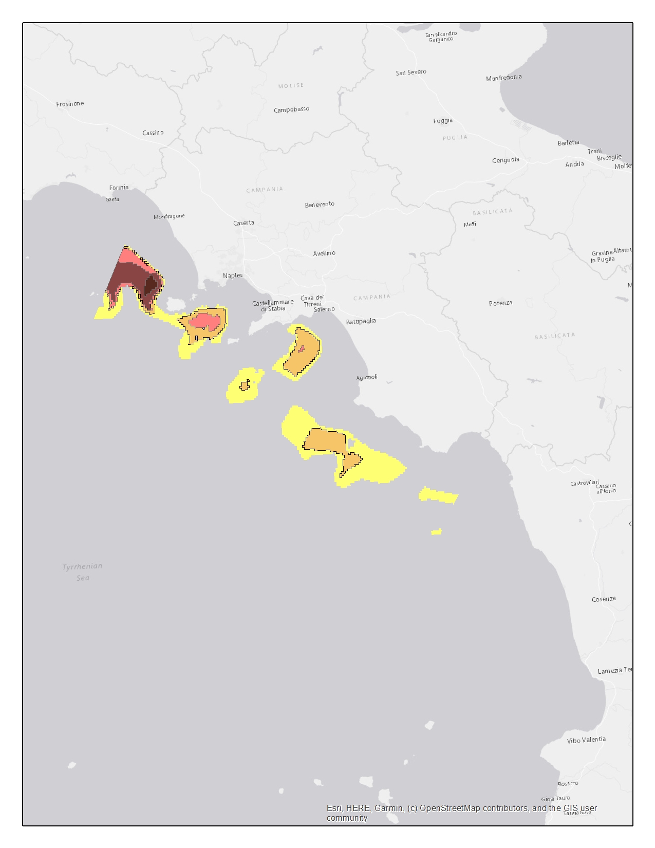
The dataset contains the Essential Fish Habitat (EFH) of 10 marine species along the coast of the Campania region. The dataset is constituted by georeferenced data on the spawning areas and the recruitment areas (nurseries) of these species, in .shp format. The data have been collected in the context of the MEDISEH project (https://imbriw.hcmr.gr/mediseh/). The procedures behind the sampling campaign and other details on the way the whole dataset was built up, are discussed in the “MEDISEH final report” attached. The MEDISEH project was conducted at Mediterranean scale. The entire dataset was handled using ArcGis according to the FEAMP objective and hence restricted to the Campania region. The present dataset includes the EFH for the following demersal and small pelagic species: Eledone cirrosa, Galeus melastomus, Illex coindetii, Merluccius merluccius, Mullus barbatus, Nephrops Norvegicus, Pagellus erhytinus, Parapenaeus longirostris, Trachurus mediterraneous, Trachurus trachurus. For each species, spatial information on the spawning areas or the recruitment areas or both are provided. The files are organized in folders, called by the shortened name of the species and the letter “c” referred to “Campania”. Each of them contains then the folder holding the shapefile, called “Recruitment” or “Spawning” or both, according to the presence/absence of spawning and nursery areas in the Campania region for each species. The shapefiles are collocated and named following the scheme: “species_c_r” for recruitment areas and “species_c_s” for the spawning areas. Ex. the “eledcir_c_r.shp” file refers to the recruitment areas of Eledone cirrosa in Campania. Spatial analysis techniques allow to identify locations that are more likely to be density hot spot areas for fish nurseries and spawning grounds. All the shapefiles are characterized by areas with increasing probability to be an EFH. For the most of the considered species, the areas of interest are featured by 5 levels of probability (0.5-20%, 20-40%, 40-60%, 60-80%, 80-100%). In the cases of Trachurus mediterraneous and Trachurus trachurus the areas are instead featured by 3 levels of probability (25-50%, 50-75%, 75-100%) both for nurseries and spawning locations.
-
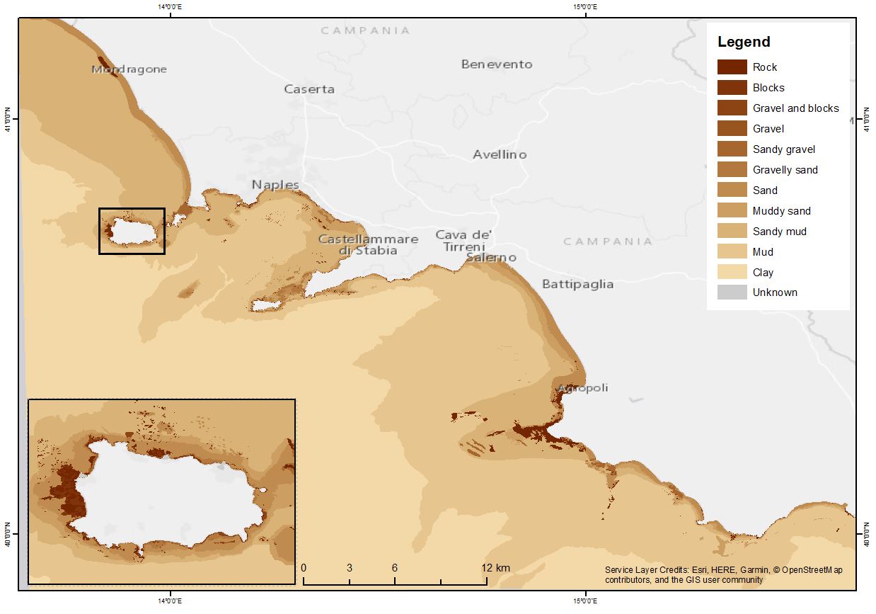
The shapefile contains the marine substrates of the Campania Region (inside 24 NM) produced in the framework of the FEAMP-ISSPA Project by CNR-ISMAR starting from the CARG cartography and the EUSeaMap from EMONnet.
-

Habitat point data from groundtruthing data in in Campania Region
-
Pictures of photo quadrats at three different depth of selected sampling sites within MPA Costa degli Infreschi e della Masseta
-

Shapefile of the maritime State Concessions 2018 - Regione Campania
-
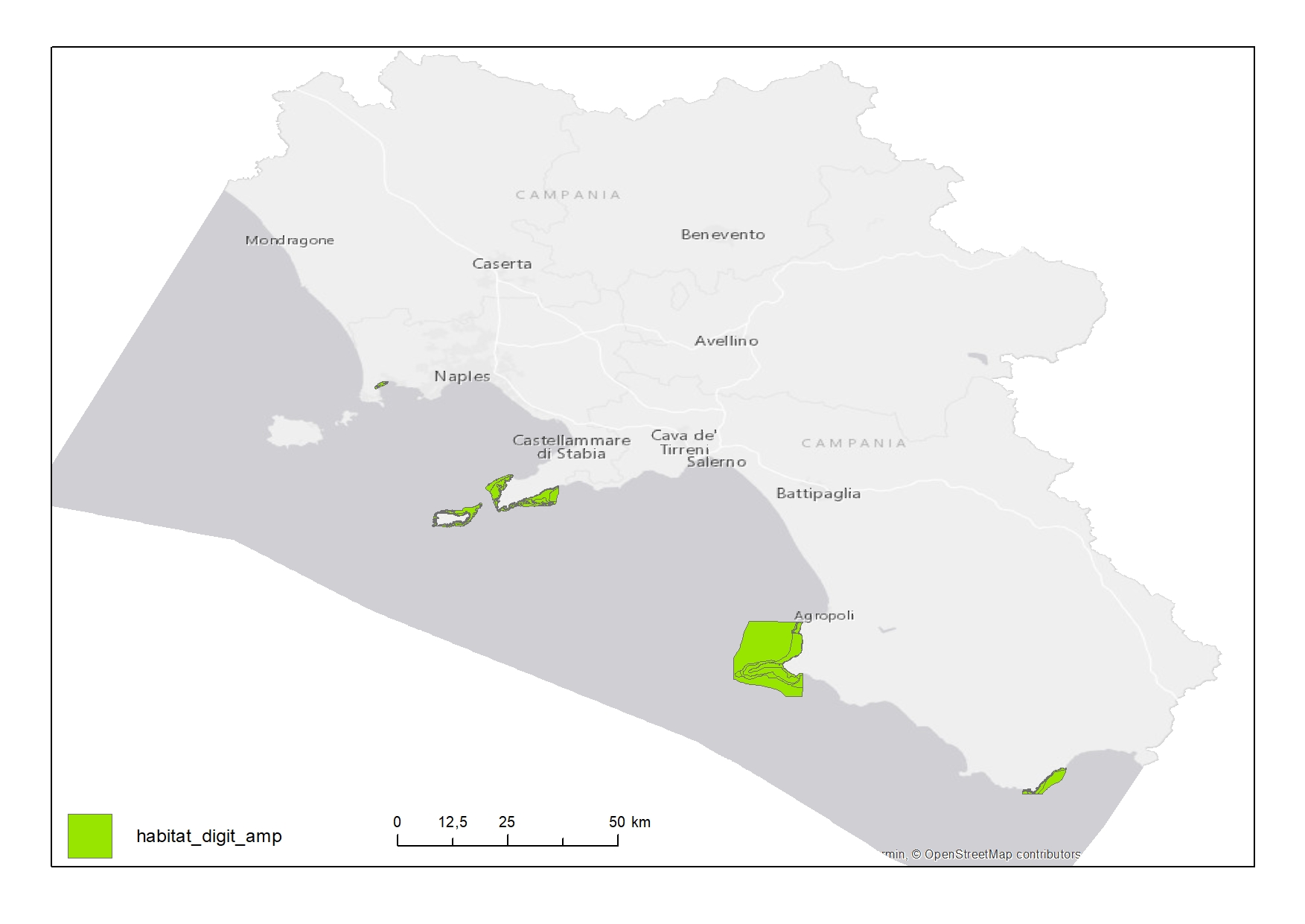
Habitat map of Marine Protected Areas (MPAs) in Campania Region